
Naples Metro map
The whole network on one map — 3 metro lines, 4 funiculars and 38 stations. Download the map as a PNG or PDF below.
Map of the Naples Metro lines
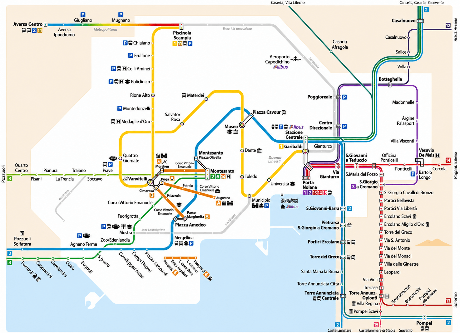
The map also shows the suburban railways (Circumvesuviana, Cumana) and the funiculars. For engineering works and temporary changes check anm.it.
Naples Metro map PDF — free download
Download the up-to-date Naples Metro map as a PDF — it stays sharp when printed or zoomed and works offline: every line, all 38 stations and the interchanges always at hand, even without a connection.
The lines and their colours
The interchange hubs
At the interchange hubs you move between lines through internal walkways or a short walk — with the TIC ticket (90 minutes) the transfer is included. At Vanvitelli, Toledo, Piazza Amedeo, Montesanto and Mergellina you also find the funiculars.
Frequently asked questions
The network has 38 stations on 3 metro lines, plus the 16 stations of the 4 funiculars — about 45 km of urban rail.
Right on this page — click «Map as PDF» and the file saves to your device. The map is also available as a PNG. Both are free, printable and work offline.
Garibaldi / Piazza Garibaldi, under the Central Station: Line 1, Line 2, national trains and the Circumvesuviana all meet here. Other key hubs are Municipio (L1+L6), Mergellina (L6+L2) and Museo–Piazza Cavour (L1+L2).
The map shows the network with Line 1 extended to Centro Direzionale (opened in 2025) and Line 6 back in service. The sections under construction (Capodichino, Di Vittorio) will open in the coming years — check anm.it before travelling if works are announced.